Live: ---
Rail: 550.00 del
{{ weatherTemp }}°C
{{ weatherCity }}
AB Direct - Steers
AB Direct - Heifers
Live: ---
Rail: 550.00 del
Rail: 550.00 del
US Trade- Steers
Live: 230.00 (TX, KS)
Rail: 365.00 (IA, NE)
Rail: 365.00 (IA, NE)
US Trade - Heifers
Live: 230.00 (TX, KS)
Rail: 365.00 (IA, NE)
Rail: 365.00 (IA, NE)
Canadian Dollar
$71.11
0.10
0.10
June 15, 2026
Business Tools
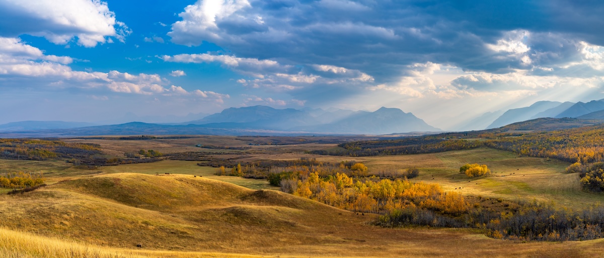
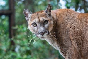
Waterton Biosphere Region seeking input on predator losses
The Waterton Biosphere Region is seeking input from livestock producers who have experienced losses to bears, wolves or cougars between 2021 and 2025.
Information collected through the survey will be used to help inform discussions around Alberta’s predator compensation program.
Producers are asked to provide up to five years of data on livestock inventories, overall death losses and predator-related losses. Personal information will remain confidential and will not be shared externally.
The survey is currently open to producers located within the Waterton Biosphere Region and will remain open until the end of June.
The survey is available online: Producer Data – Predator Losses
Paper copies can also be obtained through local municipal district offices.
Understanding the biosphere region
The Waterton Biosphere Region is a biosphere region located in southwestern Alberta.
According to the organization, biosphere reserves are traditionally organized into three zones, known as the core area, the buffer zone, and a transition zone or “area of cooperation”.
Waterton Lakes National Park, has formed the core of the biosphere reserve since designation in 1979. Adjacent provincial and private lands, with high conservation value, form a buffer zone where most activities are compatible with conservation objectives.
Beyond that lies a broad transition zone or “area of cooperation,” where communities work together to manage the land in a sustainable way. Biosphere reserves are voluntary cooperative areas. Land use is not regulated or restricted in any way by having biosphere status.
Currently WBR includes Waterton Lakes National Park; the municipalities of Pincher Creek, Cardston and Ranchland; Castle Provincial Parks; and public land south of Highway 3.
Share this article on
Latest News
-
July 23, 2026 Checking in with ABP
ABP highlights leadership, collaboration at PNWER Annual Summit
-
July 23, 2026 News
CCA and CMC welcome proposed SRM regulatory changes
-
July 22, 2026 News
4-H Alberta celebrates graduates while investing in the next generation of leaders
Cattle Report
Updated: July 24, 2026
Steers
Live: ---
Rail: 550.00 del
Heifers
Live: ---
Rail: 550.00 del
Choice Steers
Live: 230.00 (TX, KS)
Rail: 365.00 (IA, NE)
Choice Heifers
Live: 230.00 (TX, KS)
Rail: 365.00 (IA, NE)
Boner Cows
Over 500 lbs: 334.00
Canadian Dollar
$71.11 0.10
Livestock Price Insurance Index
| Expiry | Fed | Feeder | Calf |
|---|---|---|---|
| 19-Oct-26 | 294 | 470 | -- |
| 16-Nov-26 | 284 | 460 | -- |
| 14-Dec-26 | 288 | 450 | -- |
| 8-Feb-27 | 282 | 442 | -- |
| 8-Mar-27 | 282 | 440 | -- |
| 5-Apr-27 | 288 | 438 | -- |
| - | - | - | - |
Last Updated on July 23, 2026